
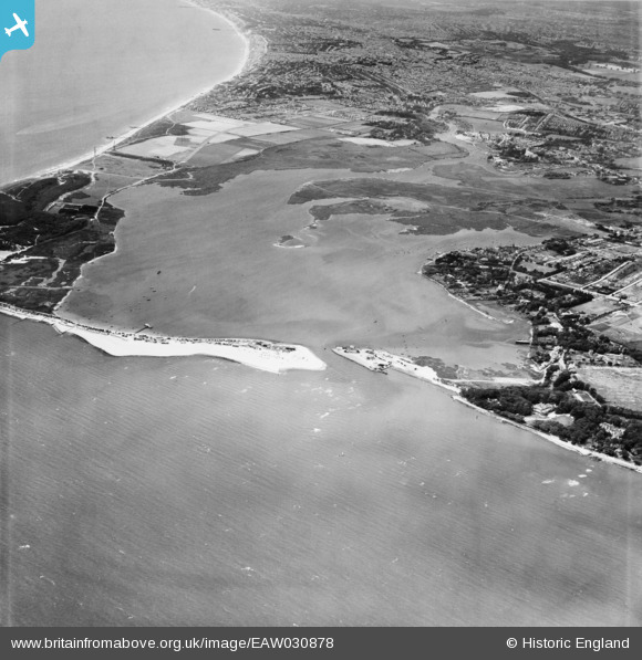
EAW030878 ENGLAND (1950). Christchurch Harbour, Christchurch, 1950
© Copyright OpenStreetMap contributors and licensed by the OpenStreetMap Foundation. 2026. Cartography is licensed as CC BY-SA.
Nearby Images (2)
EAW030878

EAW030879

Details
| Title | [EAW030878] Christchurch Harbour, Christchurch, 1950 |
| Reference | EAW030878 |
| Date | 13-July-1950 |
| Link | |
| Place name | CHRISTCHURCH |
| Parish | |
| District | |
| Country | ENGLAND |
| Easting / Northing | 418104, 91571 |
| Longitude / Latitude | -1.743496409152, 50.722906833836 |
| National Grid Reference | SZ181916 |
Pins

BarryStone |
Thursday 20th of July 2017 04:00:13 PM | |
|
BarryStone |
Thursday 20th of July 2017 03:38:09 PM | |

Class31 |
Monday 12th of October 2015 10:36:20 PM | |
|
Class31 |
Monday 12th of October 2015 10:35:36 PM | |
|
chainbull |
Saturday 26th of July 2014 07:55:53 PM | |
|
FONFA |
Thursday 24th of July 2014 06:15:37 PM |


User Comment Contributions

From Hengistbury Head, looking north, 07/09/2014 |
Class31 |
Tuesday 9th of September 2014 02:57:06 PM |