
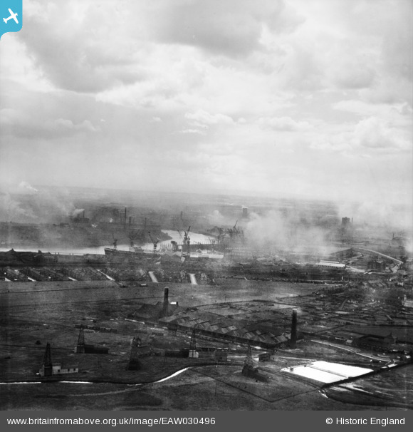
EAW030496 ENGLAND (1950). High Clarence and the River Tees, Billingham, from the north-east, 1950
© Copyright OpenStreetMap contributors and licensed by the OpenStreetMap Foundation. 2025. Cartography is licensed as CC BY-SA.
Nearby Images (3)
EAW030496

EAW032534

EAW032535

Details
| Title | [EAW030496] High Clarence and the River Tees, Billingham, from the north-east, 1950 |
| Reference | EAW030496 |
| Date | 23-June-1950 |
| Link | |
| Place name | BILLINGHAM |
| Parish | BILLINGHAM |
| District | |
| Country | ENGLAND |
| Easting / Northing | 449415, 522516 |
| Longitude / Latitude | -1.2351082813531, 54.595287785524 |
| National Grid Reference | NZ494225 |
Pins

J May |
Monday 11th of January 2021 02:31:55 PM | |
|
J May |
Monday 11th of January 2021 02:31:16 PM | |
|
J May |
Monday 11th of January 2021 02:30:02 PM | |
|
J May |
Monday 11th of January 2021 02:28:47 PM | |
|
J May |
Monday 11th of January 2021 02:28:19 PM | |
|
J May |
Monday 11th of January 2021 02:27:19 PM |