
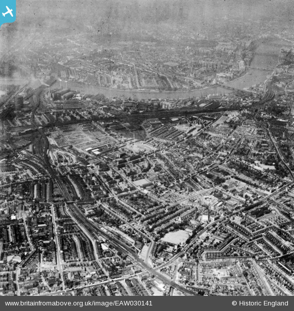
EAW030141 ENGLAND (1950). Wandsworth Road and the South Lambeth area, South Lambeth, 1950. This image has been produced from a print.
© Copyright OpenStreetMap contributors and licensed by the OpenStreetMap Foundation. 2026. Cartography is licensed as CC BY-SA.
Nearby Images (8)
EAW030141

EPW017173

EPW032047

EPW032049

EPW032046

EPW032048

EAW030140

EPW017666

Details
| Title | [EAW030141] Wandsworth Road and the South Lambeth area, South Lambeth, 1950. This image has been produced from a print. |
| Reference | EAW030141 |
| Date | 6-June-1950 |
| Link | |
| Place name | SOUTH LAMBETH |
| Parish | |
| District | |
| Country | ENGLAND |
| Easting / Northing | 529716, 176652 |
| Longitude / Latitude | -0.13206810516641, 51.473454355205 |
| National Grid Reference | TQ297767 |
Pins

JimEff |
Wednesday 13th of November 2024 11:07:25 PM | |
|
JimEff |
Wednesday 13th of November 2024 10:51:30 PM | |
|
Robin |
Friday 7th of June 2024 12:46:50 AM | |
|
Robin |
Friday 7th of June 2024 12:46:04 AM | |
|
Robin |
Friday 7th of June 2024 12:41:46 AM | |
|
JimEff |
Monday 21st of August 2023 04:25:24 PM | |
|
JimEff |
Monday 21st of August 2023 04:20:17 PM | |
|
JimEff |
Monday 21st of August 2023 04:18:45 PM | |
|
JimEff |
Monday 21st of August 2023 04:17:24 PM | |
|
JimEff |
Monday 21st of August 2023 04:17:19 PM | |
|
David960 |
Tuesday 17th of January 2023 12:18:33 PM | |
|
1IG |
Thursday 18th of June 2015 11:46:15 AM | |
|
brianbeckett |
Wednesday 1st of October 2014 07:48:28 PM | |
|
brianbeckett |
Wednesday 1st of October 2014 07:47:58 PM | |
|
brianbeckett |
Wednesday 1st of October 2014 07:46:54 PM |