
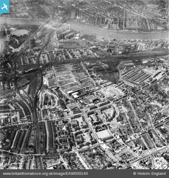
EAW030140 ENGLAND (1950). Wandsworth Road and environs, South Lambeth, 1950. This image has been produced from a print.
© Copyright OpenStreetMap contributors and licensed by the OpenStreetMap Foundation. 2026. Cartography is licensed as CC BY-SA.
Nearby Images (7)
EAW030140

EPW032049

EPW032046

EPW032047

EPW032048

EAW030141

EAW000663

Details
| Title | [EAW030140] Wandsworth Road and environs, South Lambeth, 1950. This image has been produced from a print. |
| Reference | EAW030140 |
| Date | 6-June-1950 |
| Link | |
| Place name | SOUTH LAMBETH |
| Parish | |
| District | |
| Country | ENGLAND |
| Easting / Northing | 529471, 176761 |
| Longitude / Latitude | -0.13555418551513, 51.474490152105 |
| National Grid Reference | TQ295768 |
Pins

1IG |
Thursday 5th of September 2024 09:18:51 AM | |
|
1IG |
Thursday 5th of September 2024 08:58:57 AM | |
|
1IG |
Thursday 5th of September 2024 08:58:31 AM | |
|
1IG |
Thursday 5th of September 2024 08:57:15 AM | |
|
1IG |
Thursday 5th of September 2024 08:56:48 AM | |
|
1IG |
Thursday 5th of September 2024 08:56:17 AM | |
|
1IG |
Thursday 5th of September 2024 08:55:43 AM | |
|
1IG |
Thursday 5th of September 2024 08:54:46 AM | |
|
1IG |
Thursday 5th of September 2024 08:53:25 AM | |
|
1IG |
Thursday 5th of September 2024 08:52:37 AM | |
|
1IG |
Thursday 5th of September 2024 08:51:57 AM | |
|
Brightonboy |
Friday 19th of August 2016 07:49:16 AM | |
|
Brightonboy |
Friday 19th of August 2016 07:46:21 AM | |
|
Brightonboy |
Friday 19th of August 2016 07:45:35 AM | |
|
Brightonboy |
Friday 19th of August 2016 07:44:53 AM | |
|
Brightonboy |
Friday 19th of August 2016 07:41:19 AM | |
|
Brightonboy |
Friday 19th of August 2016 07:39:51 AM | |
|
Brightonboy |
Friday 19th of August 2016 07:39:02 AM | |
|
Brightonboy |
Friday 19th of August 2016 07:38:22 AM | |
|
brianbeckett |
Wednesday 1st of October 2014 07:49:50 PM |