
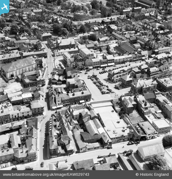
EAW029743 ENGLAND (1950). Cornhill, Brentgovel Street and environs, Bury St Edmunds, 1950
© Copyright OpenStreetMap contributors and licensed by the OpenStreetMap Foundation. 2026. Cartography is licensed as CC BY-SA.
Nearby Images (4)
EAW029743

EPW001749

EPW001751

EAW029742

Details
| Title | [EAW029743] Cornhill, Brentgovel Street and environs, Bury St Edmunds, 1950 |
| Reference | EAW029743 |
| Date | 30-May-1950 |
| Link | |
| Place name | BURY ST EDMUNDS |
| Parish | BURY ST. EDMUNDS |
| District | |
| Country | ENGLAND |
| Easting / Northing | 585271, 264363 |
| Longitude / Latitude | 0.71415807211038, 52.245816392267 |
| National Grid Reference | TL853644 |
Pins

Joan Abbs |
Monday 20th of May 2019 09:01:58 AM | |

Sparky |
Monday 4th of September 2017 11:45:12 AM | |
|
Sparky |
Monday 4th of September 2017 11:44:21 AM | |
|
MorrisDancer |
Wednesday 6th of May 2015 10:28:59 PM | |
|
MorrisDancer |
Wednesday 6th of May 2015 08:07:05 PM | |
|
MorrisDancer |
Wednesday 6th of May 2015 08:05:24 PM |

