
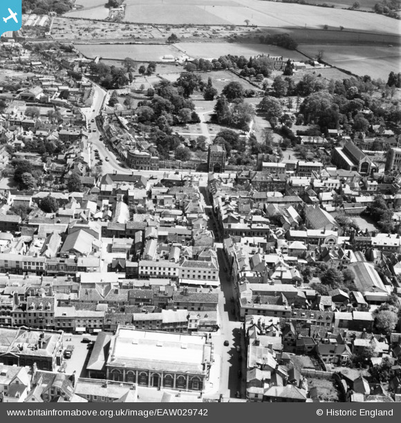
EAW029742 ENGLAND (1950). Abbeygate Street and the abbey, Bury St Edmunds, 1950
© Copyright OpenStreetMap contributors and licensed by the OpenStreetMap Foundation. 2026. Cartography is licensed as CC BY-SA.
Nearby Images (12)
EAW029742

EPW001753

EPW025024

EPW025022

EAW024397

EPW025020

EPW001749

EAW024395

EAW029743

EAW024398

EPW025023

EPW025021

Details
| Title | [EAW029742] Abbeygate Street and the abbey, Bury St Edmunds, 1950 |
| Reference | EAW029742 |
| Date | 30-May-1950 |
| Link | |
| Place name | BURY ST EDMUNDS |
| Parish | BURY ST. EDMUNDS |
| District | |
| Country | ENGLAND |
| Easting / Northing | 585445, 264221 |
| Longitude / Latitude | 0.71662606289773, 52.244482452905 |
| National Grid Reference | TL854642 |
Pins

Matt Aldred edob.mattaldred.com |
Sunday 26th of January 2020 09:45:11 PM |