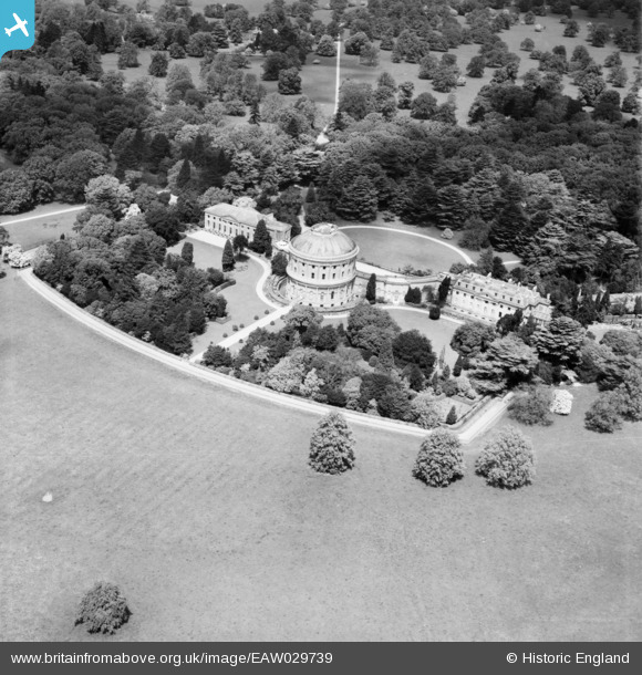
EAW029739 ENGLAND (1950). Ickworth House, Ickworth Park, 1950
© Copyright OpenStreetMap contributors and licensed by the OpenStreetMap Foundation. 2025. Cartography is licensed as CC BY-SA.
Details
| Title | [EAW029739] Ickworth House, Ickworth Park, 1950 |
| Reference | EAW029739 |
| Date | 30-May-1950 |
| Link | |
| Place name | ICKWORTH PARK |
| Parish | ICKWORTH |
| District | |
| Country | ENGLAND |
| Easting / Northing | 581588, 261294 |
| Longitude / Latitude | 0.65861855817878, 52.219479115709 |
| National Grid Reference | TL816613 |
Pins
Be the first to add a comment to this image!


![[EAW029739] Ickworth House, Ickworth Park, 1950](http://britainfromabove.org.uk/sites/all/libraries/aerofilms-images/public/100x100/EAW/029/EAW029739.jpg)
![[EAW029741] Ickworth House, Ickworth Park, 1950](http://britainfromabove.org.uk/sites/all/libraries/aerofilms-images/public/100x100/EAW/029/EAW029741.jpg)
![[EAW029740] Ickworth House, Ickworth Park, 1950](http://britainfromabove.org.uk/sites/all/libraries/aerofilms-images/public/100x100/EAW/029/EAW029740.jpg)


