
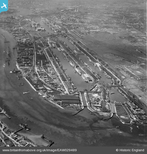
EAW029489 ENGLAND (1950). The Royal Group of Docks, North Woolwich, from the east, 1950
© Copyright OpenStreetMap contributors and licensed by the OpenStreetMap Foundation. 2026. Cartography is licensed as CC BY-SA.
Nearby Images (22)
EAW029489

EAW008736

EAW008737

EAW008733

EAW008738

EAW008735

EAW008748

EAW008729

EAW008731

EAW049352

EAW008734

EAW029488

EAW008732

EAW008730

EPW044115

EAW000036

EPW008553

EPW044126

EAW046497

EPW024257

EPW044125

EPW044122

Details
| Title | [EAW029489] The Royal Group of Docks, North Woolwich, from the east, 1950 |
| Reference | EAW029489 |
| Date | 11-May-1950 |
| Link | |
| Place name | NORTH WOOLWICH |
| Parish | |
| District | |
| Country | ENGLAND |
| Easting / Northing | 543931, 180113 |
| Longitude / Latitude | 0.073904433249023, 51.501119079049 |
| National Grid Reference | TQ439801 |
Pins
Be the first to add a comment to this image!