
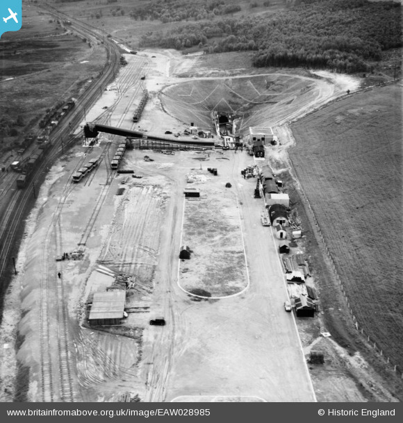
EAW028985 ENGLAND (1950). Dragonby Ironstone Mine, Dragonby, 1950
© Copyright OpenStreetMap contributors and licensed by the OpenStreetMap Foundation. 2026. Cartography is licensed as CC BY-SA.
Nearby Images (9)
EAW028985

EAW028984

EAW028989

EAW028987

EAW028988

EAW028986

EAW028994

EAW028997

EAW028992

Details
| Title | [EAW028985] Dragonby Ironstone Mine, Dragonby, 1950 |
| Reference | EAW028985 |
| Date | 8-May-1950 |
| Link | |
| Place name | DRAGONBY |
| Parish | ROXBY CUM RISBY |
| District | |
| Country | ENGLAND |
| Easting / Northing | 490341, 414636 |
| Longitude / Latitude | -0.63402161469042, 53.620225875371 |
| National Grid Reference | SE903146 |
