
EAW028756 ENGLAND (1950). Shoe Lane, Farringdon Street, Holborn Viaduct Station and environs, London, 1950. This image was marked by Aerofilms Ltd for photo editing.

© Copyright OpenStreetMap contributors and licensed by the OpenStreetMap Foundation. 2026. Cartography is licensed as CC BY-SA.
Nearby Images (48)
EAW028756

EAW022418

EAW021727

EAW028758

EAW020402

EAW028755

EAW044243

EAW020408

EAW028756A

EAW020407

EAW022415

EAW039240

EAW020409

EAW022419

EAW028754

EAW022421

EAW000627

EAW020405

EPW011929

EAW011097

EPW045609

EAW022420

EAW022417

EPW021402

EAW010073

EAW000628

EAW020410

EPW009015

EAW022422

EAW028782

EPW005131

EAW028760

EPW019310

EAW011182

EAW028762

EAW011181

EAW011108

EAW028763

EAW028761

EPW005904

EAW028777

EAW022423

EAW011189
 and Giltspur Street, London, 1947")
EAW022424

EPW055354

EAW018348

EPW019309

EAW020406

Details
| Title | [EAW028756] Shoe Lane, Farringdon Street, Holborn Viaduct Station and environs, London, 1950. This image was marked by Aerofilms Ltd for photo editing. |
| Reference | EAW028756 |
| Date | 20-April-1950 |
| Link | |
| Place name | LONDON |
| Parish | |
| District | |
| Country | ENGLAND |
| Easting / Northing | 531555, 181365 |
| Longitude / Latitude | -0.10384443907489, 51.51538818256 |
| National Grid Reference | TQ316814 |
Pins

Class31 |
Saturday 14th of June 2014 07:02:13 PM | |

Alan McFaden |
Saturday 24th of May 2014 09:46:01 AM | |
|
Class31 |
Tuesday 13th of May 2014 09:55:17 AM | |
|
Class31 |
Tuesday 13th of May 2014 09:49:55 AM | |
|
Alan McFaden |
Tuesday 18th of February 2014 06:33:51 PM | |
|
Alan McFaden |
Tuesday 18th of February 2014 06:33:11 PM | |
|
Alan McFaden |
Tuesday 18th of February 2014 06:32:36 PM |


User Comment Contributions
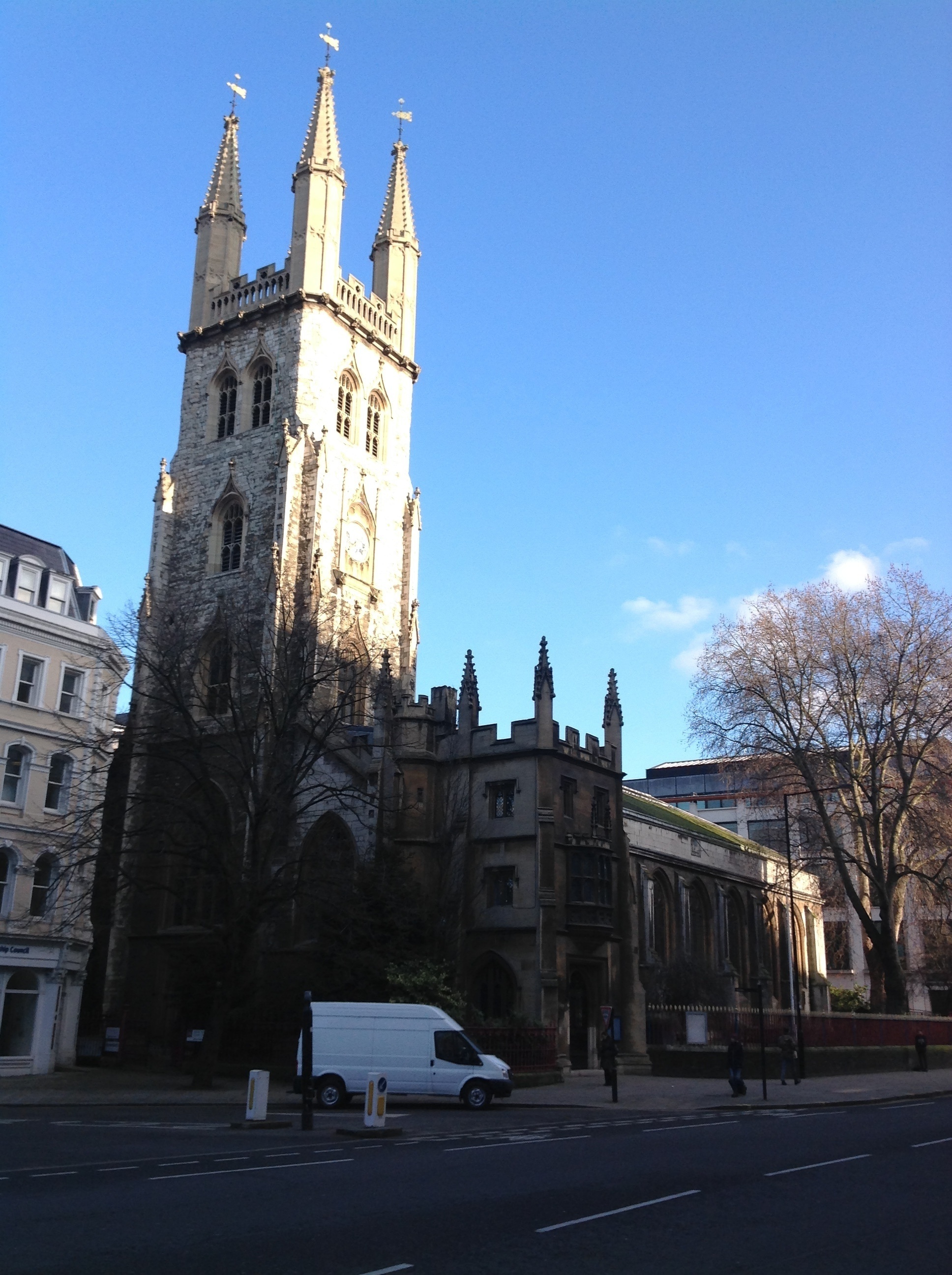
Church of the Holy Sepulcre Without, Newgate 19/01/2015 |
Class31 |
Friday 23rd of January 2015 09:12:53 AM |
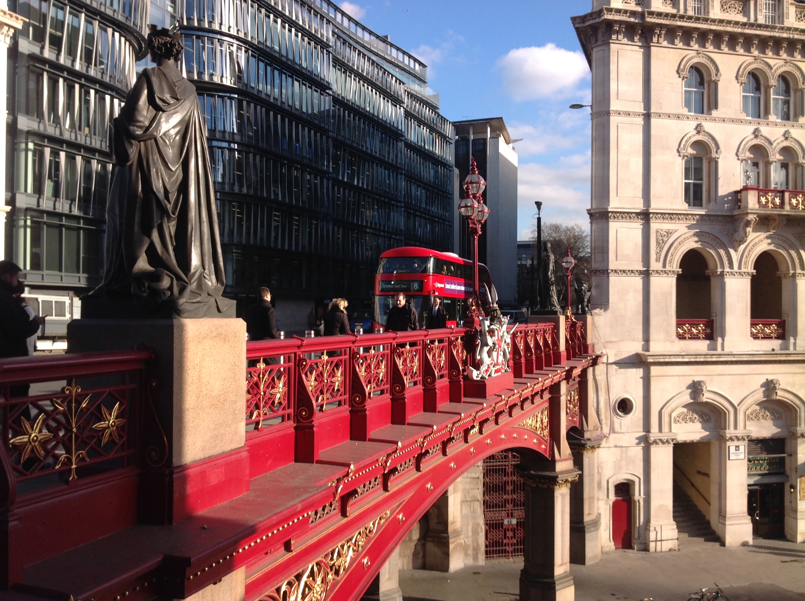
Holborn Viaduct, 19/01/2015 |
Class31 |
Friday 23rd of January 2015 09:06:07 AM |

Holborn Viaduct, 19/01/2015 |
Class31 |
Friday 23rd of January 2015 09:05:42 AM |

The Old Bailey, 19/01/2015 |
Class31 |
Friday 23rd of January 2015 09:04:57 AM |

Ludgate Hill, 19/01/2015 |
Class31 |
Friday 23rd of January 2015 09:04:24 AM |

Farringdon Street |
Alan McFaden |
Wednesday 10th of December 2014 01:40:56 PM |