
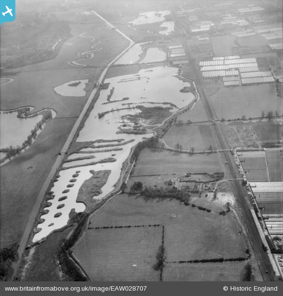
EAW028707 ENGLAND (1950). Gravel workings along the River Lea (or Lee) Navigation, Cheshunt, 1950
© Copyright OpenStreetMap contributors and licensed by the OpenStreetMap Foundation. 2026. Cartography is licensed as CC BY-SA.
Nearby Images (3)
EAW028707
 Navigation, Cheshunt, 1950")
EAW028705
 Navigation, Cheshunt, 1950. This image was marked by Aerofilms Ltd for photo editing.")
EAW028704
 Navigation, Cheshunt, 1950")
Details
| Title | [EAW028707] Gravel workings along the River Lea (or Lee) Navigation, Cheshunt, 1950 |
| Reference | EAW028707 |
| Date | 20-April-1950 |
| Link | |
| Place name | CHESHUNT |
| Parish | |
| District | |
| Country | ENGLAND |
| Easting / Northing | 536959, 203726 |
| Longitude / Latitude | -0.017263023253973, 51.715061261527 |
| National Grid Reference | TL370037 |
Pins

David Dent |
Sunday 1st of January 2023 02:58:01 PM | |
|
redmist |
Thursday 24th of February 2022 10:03:58 PM |