
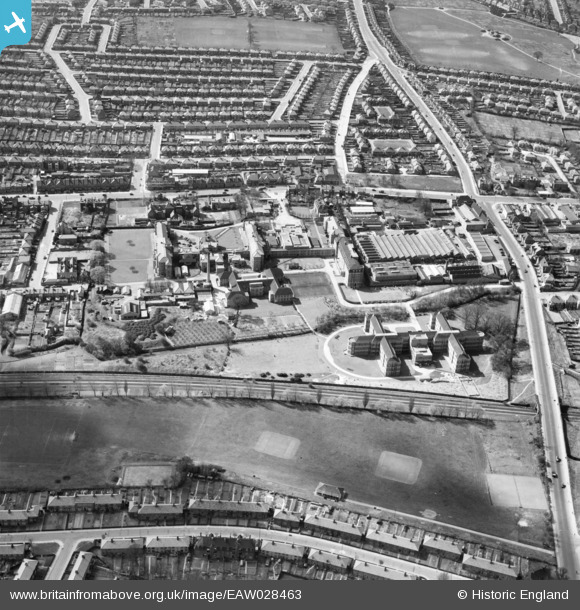
EAW028463 ENGLAND (1950). The Edgware General Hospital and the surrounding residential area, Burnt Oak, 1950
© Copyright OpenStreetMap contributors and licensed by the OpenStreetMap Foundation. 2026. Cartography is licensed as CC BY-SA.
Nearby Images (25)
EAW028463

EAW028461

EAW028459

EPW015981

EPW020061

EAW028466

EAW028467

EAW028460

EPW020059

EPW020058

EPW020057

EPW020060

EAW028462

EPW001354

EPW020054

EPW001355

EPW020056

EAW028465

EPW020055

EPW020062

EPW016825

EPW016826

EAW028464

EPW015339

EPW016827

Details
| Title | [EAW028463] The Edgware General Hospital and the surrounding residential area, Burnt Oak, 1950 |
| Reference | EAW028463 |
| Date | 29-March-1950 |
| Link | |
| Place name | BURNT OAK |
| Parish | |
| District | |
| Country | ENGLAND |
| Easting / Northing | 519841, 191137 |
| Longitude / Latitude | -0.26926440278245, 51.605828979275 |
| National Grid Reference | TQ198911 |
Pins
Be the first to add a comment to this image!