
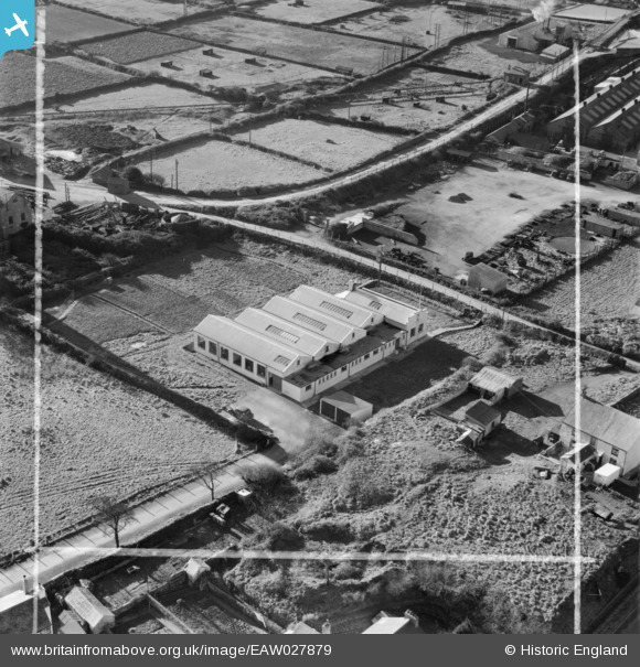
EAW027879 ENGLAND (1950). Tools and Drawing Dies Ltd Engineering Works, Pool, 1950. This image was marked by Aerofilms Ltd for photo editing.
© Copyright OpenStreetMap contributors and licensed by the OpenStreetMap Foundation. 2026. Cartography is licensed as CC BY-SA.
Nearby Images (17)
EAW027879

EAW027880

EAW027878

EAW027877

EAW027869

EAW027876

EAW027873

EAW027870

EAW027875

EAW027871

EAW027874

EAW027872

EPW059615

EAW033748

EAW033749

EPW059612

EAW033747

Details
| Title | [EAW027879] Tools and Drawing Dies Ltd Engineering Works, Pool, 1950. This image was marked by Aerofilms Ltd for photo editing. |
| Reference | EAW027879 |
| Date | 17-January-1950 |
| Link | |
| Place name | POOL |
| Parish | CARN BREA |
| District | |
| Country | ENGLAND |
| Easting / Northing | 166704, 41359 |
| Longitude / Latitude | -5.271233467929, 50.225518011302 |
| National Grid Reference | SW667414 |
Pins
Be the first to add a comment to this image!