
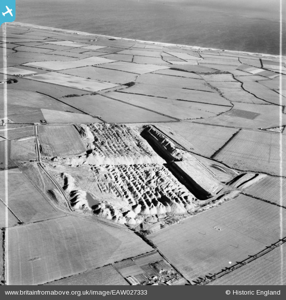
EAW027333 ENGLAND (1949). Opencast Coal Mining site opposite the village, Widdrington Station, 1949. This image was marked by Aerofilms Ltd for photo editing.
© Copyright OpenStreetMap contributors and licensed by the OpenStreetMap Foundation. 2026. Cartography is licensed as CC BY-SA.
Nearby Images (6)
EAW027333

EAW027340

EAW027339

EAW027332

EAW027330

EAW027331

Details
| Title | [EAW027333] Opencast Coal Mining site opposite the village, Widdrington Station, 1949. This image was marked by Aerofilms Ltd for photo editing. |
| Reference | EAW027333 |
| Date | 21-October-1949 |
| Link | |
| Place name | WIDDRINGTON STATION |
| Parish | WIDDRINGTON STATION AND STOBSWOOD |
| District | |
| Country | ENGLAND |
| Easting / Northing | 425437, 593433 |
| Longitude / Latitude | -1.5999763156207, 55.23440407404 |
| National Grid Reference | NZ254934 |
