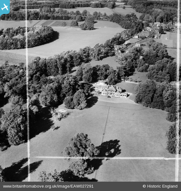
EAW027291 ENGLAND (1949). Wans House and environs, Chittoe, 1949. This image was marked by Aerofilms Ltd for photo editing.
© Copyright OpenStreetMap contributors and licensed by the OpenStreetMap Foundation. 2025. Cartography is licensed as CC BY-SA.
Nearby Images (9)
Details
| Title | [EAW027291] Wans House and environs, Chittoe, 1949. This image was marked by Aerofilms Ltd for photo editing. |
| Reference | EAW027291 |
| Date | 19-October-1949 |
| Link | |
| Place name | CHITTOE |
| Parish | BROMHAM |
| District | |
| Country | ENGLAND |
| Easting / Northing | 396659, 167570 |
| Longitude / Latitude | -2.0480389211448, 51.406651570023 |
| National Grid Reference | ST967676 |
Pins
Be the first to add a comment to this image!


![[EAW027291] Wans House and environs, Chittoe, 1949. This image was marked by Aerofilms Ltd for photo editing.](http://britainfromabove.org.uk/sites/all/libraries/aerofilms-images/public/100x100/EAW/027/EAW027291.jpg)
![[EAW026889] Wans House, Sandy Lane, 1949. This image has been produced from a print.](http://britainfromabove.org.uk/sites/all/libraries/aerofilms-images/public/100x100/EAW/026/EAW026889.jpg)
![[EAW026887] Wans House, Sandy Lane, 1949. This image has been produced from a print.](http://britainfromabove.org.uk/sites/all/libraries/aerofilms-images/public/100x100/EAW/026/EAW026887.jpg)
![[EAW026889A] Wans House, Sandy Lane, 1949. This image has been produced from a print marked by Aerofilms Ltd for photo editing.](http://britainfromabove.org.uk/sites/all/libraries/aerofilms-images/public/100x100/EAW/026/EAW026889A.jpg)
![[EAW026888] Wans House, Sandy Lane, 1949. This image has been produced from a print.](http://britainfromabove.org.uk/sites/all/libraries/aerofilms-images/public/100x100/EAW/026/EAW026888.jpg)
![[EAW027289] Wans House and environs, Chittoe, 1949. This image was marked by Aerofilms Ltd for photo editing.](http://britainfromabove.org.uk/sites/all/libraries/aerofilms-images/public/100x100/EAW/027/EAW027289.jpg)
![[EAW026886] Wans House, Sandy Lane, 1949. This image has been produced from a print.](http://britainfromabove.org.uk/sites/all/libraries/aerofilms-images/public/100x100/EAW/026/EAW026886.jpg)
![[EAW027290] Wans House and environs, Sandy Lane, 1949. This image was marked by Aerofilms Ltd for photo editing.](http://britainfromabove.org.uk/sites/all/libraries/aerofilms-images/public/100x100/EAW/027/EAW027290.jpg)
![[EAW027288] Wans House and environs, Chittoe, from the east, 1949. This image was marked by Aerofilms Ltd for photo editing.](http://britainfromabove.org.uk/sites/all/libraries/aerofilms-images/public/100x100/EAW/027/EAW027288.jpg)