
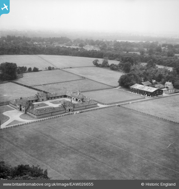
EAW026655 ENGLAND (1949). The Windsor Forest Stud, North Ascot, from the north-east, 1949
© Copyright OpenStreetMap contributors and licensed by the OpenStreetMap Foundation. 2026. Cartography is licensed as CC BY-SA.
Nearby Images (11)
EAW026655

EAW026660

EAW026652

EAW026654

EPW035066

EAW026659

EAW026653

EAW026656

EAW026657

EAW026658

EAW026651

Details
| Title | [EAW026655] The Windsor Forest Stud, North Ascot, from the north-east, 1949 |
| Reference | EAW026655 |
| Date | 22-September-1949 |
| Link | |
| Place name | NORTH ASCOT |
| Parish | WINKFIELD |
| District | |
| Country | ENGLAND |
| Easting / Northing | 490853, 169893 |
| Longitude / Latitude | -0.69324739919475, 51.420267420445 |
| National Grid Reference | SU909699 |
Pins
Be the first to add a comment to this image!