
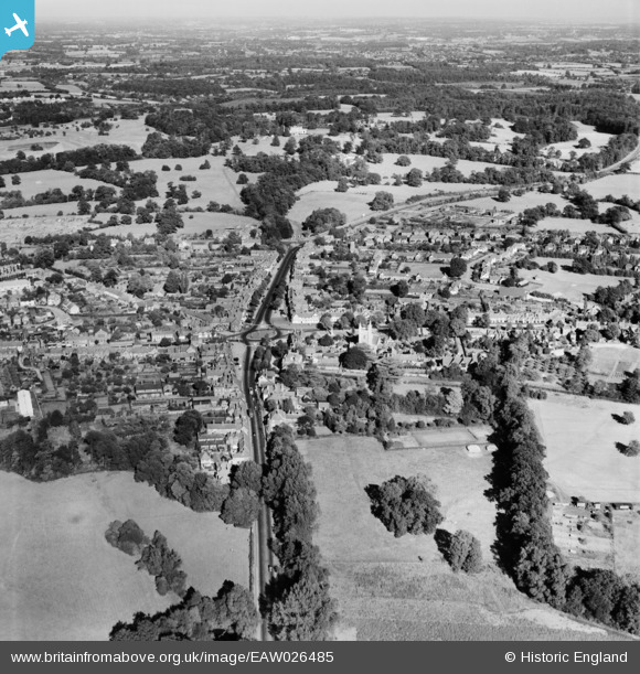
EAW026485 ENGLAND (1949). The town, Beaconsfield, from the west, 1949
© Copyright OpenStreetMap contributors and licensed by the OpenStreetMap Foundation. 2026. Cartography is licensed as CC BY-SA.
Nearby Images (3)
EAW026485

EAW026484

EPW054667

Details
| Title | [EAW026485] The town, Beaconsfield, from the west, 1949 |
| Reference | EAW026485 |
| Date | 10-September-1949 |
| Link | |
| Place name | BEACONSFIELD |
| Parish | BEACONSFIELD |
| District | |
| Country | ENGLAND |
| Easting / Northing | 494262, 189989 |
| Longitude / Latitude | -0.63885574166746, 51.600372919654 |
| National Grid Reference | SU943900 |
Pins
Be the first to add a comment to this image!