
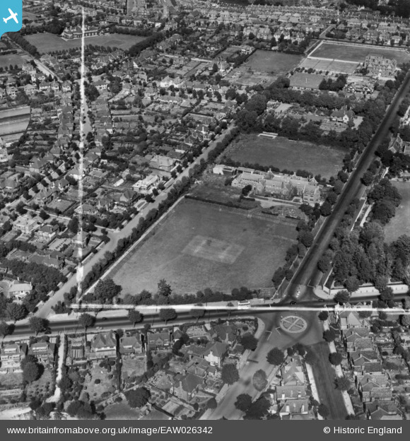
EAW026342 ENGLAND (1949). Cottesmore School and environs, Hove, 1949. This image has been produced from a print marked by Aerofilms Ltd for photo editing.
© Copyright OpenStreetMap contributors and licensed by the OpenStreetMap Foundation. 2026. Cartography is licensed as CC BY-SA.
Nearby Images (9)
EAW026342

EAW026343

EAW026341

EAW026340

EAW022697

EAW022698

EAW022695

EAW022696

EPW022696

Details
| Title | [EAW026342] Cottesmore School and environs, Hove, 1949. This image has been produced from a print marked by Aerofilms Ltd for photo editing. |
| Reference | EAW026342 |
| Date | 5-September-1949 |
| Link | |
| Place name | HOVE |
| Parish | |
| District | |
| Country | ENGLAND |
| Easting / Northing | 529545, 105799 |
| Longitude / Latitude | -0.16004258370795, 50.836643242918 |
| National Grid Reference | TQ295058 |
Pins
Be the first to add a comment to this image!