
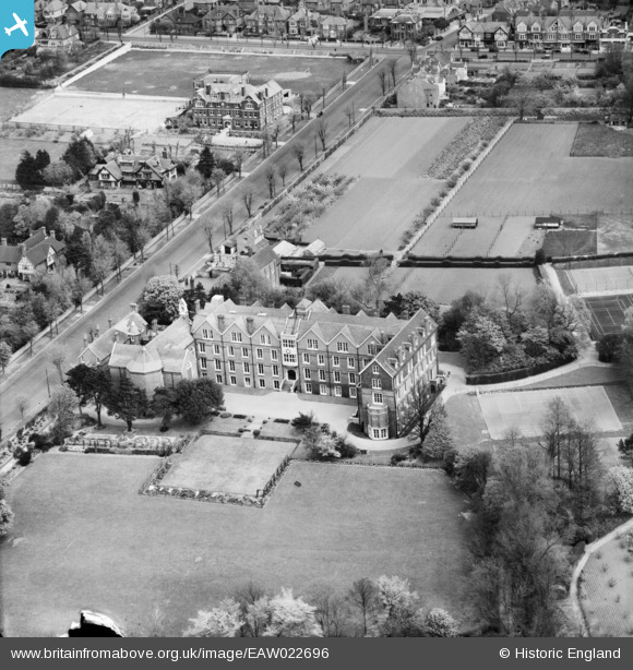
EAW022696 ENGLAND (1949). Convent of the Sacred Heart School and The Upper Drive, Hove, 1949
© Copyright OpenStreetMap contributors and licensed by the OpenStreetMap Foundation. 2026. Cartography is licensed as CC BY-SA.
Nearby Images (10)
EAW022696

EAW022695

EAW022698

EPW022696

EAW022697

EAW022699

EAW026340

EAW026343

EAW026341

EAW026342

Details
| Title | [EAW022696] Convent of the Sacred Heart School and The Upper Drive, Hove, 1949 |
| Reference | EAW022696 |
| Date | 25-April-1949 |
| Link | |
| Place name | HOVE |
| Parish | |
| District | |
| Country | ENGLAND |
| Easting / Northing | 529776, 105751 |
| Longitude / Latitude | -0.15678045091701, 50.836160012098 |
| National Grid Reference | TQ298058 |
Pins

Alan McFaden |
Sunday 31st of August 2014 03:37:12 PM | |
|
Alan McFaden |
Sunday 31st of August 2014 03:35:42 PM | |
|
Alan McFaden |
Wednesday 13th of August 2014 03:27:34 PM | |
|
Alan McFaden |
Wednesday 13th of August 2014 03:27:00 PM | |
|
Alan McFaden |
Wednesday 13th of August 2014 03:26:19 PM |


User Comment Contributions

The Dyke PH 2014 |
Alan McFaden |
Sunday 31st of August 2014 03:36:31 PM |

The Upper Drive 2014 |
Alan McFaden |
Sunday 31st of August 2014 03:36:08 PM |