
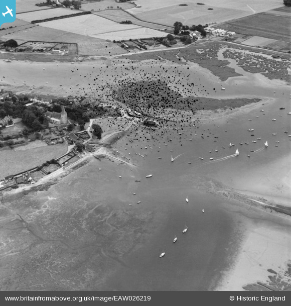
EAW026219 ENGLAND (1949). Bosham Quay and the village, Bosham, 1949. This image has been produced from a damaged negative.
© Copyright OpenStreetMap contributors and licensed by the OpenStreetMap Foundation. 2026. Cartography is licensed as CC BY-SA.
Nearby Images (4)
EAW026219

EAW026224

EAW026223

EAW026221

Details
| Title | [EAW026219] Bosham Quay and the village, Bosham, 1949. This image has been produced from a damaged negative. |
| Reference | EAW026219 |
| Date | 12-August-1949 |
| Link | |
| Place name | BOSHAM |
| Parish | BOSHAM |
| District | |
| Country | ENGLAND |
| Easting / Northing | 480296, 103866 |
| Longitude / Latitude | -0.85976766518154, 50.828194471283 |
| National Grid Reference | SU803039 |
Pins

Good Old Uncle Ted |
Thursday 1st of December 2022 06:21:21 PM | |
|
MB |
Tuesday 18th of March 2014 11:34:27 PM |