
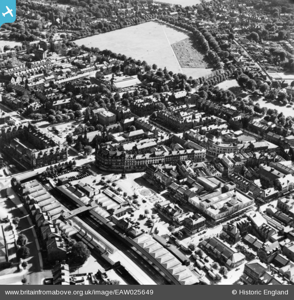
EAW025649 ENGLAND (1949). Station Square, part of the Stray or Two Hundred Acre and environs, Harrogate, 1949. This image has been produced from a print.
© Copyright OpenStreetMap contributors and licensed by the OpenStreetMap Foundation. 2026. Cartography is licensed as CC BY-SA.
Nearby Images (12)
EAW025649

EAW025651

EPW015798

EAW025655

EPW015799

EPW015801

EPW016250

EPW016246

EPW023552

EPW043174

EPW043175

EPW043176

Details
| Title | [EAW025649] Station Square, part of the Stray or Two Hundred Acre and environs, Harrogate, 1949. This image has been produced from a print. |
| Reference | EAW025649 |
| Date | 3-August-1949 |
| Link | |
| Place name | HARROGATE |
| Parish | |
| District | |
| Country | ENGLAND |
| Easting / Northing | 430328, 455196 |
| Longitude / Latitude | -1.5373726213723, 53.991723682762 |
| National Grid Reference | SE303552 |
Pins
Be the first to add a comment to this image!