
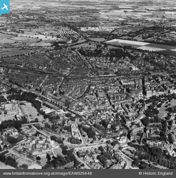
EAW025648 ENGLAND (1949). The town, Harrogate, 1949. This image has been produced from a print.
© Copyright OpenStreetMap contributors and licensed by the OpenStreetMap Foundation. 2026. Cartography is licensed as CC BY-SA.
Nearby Images (11)
EAW025648

EAW025655

EPW015801

EPW015798

EPW016246

EPW016250

EPW023552

EPW023546

EPW043175

EPW043176

EPW023545

Details
| Title | [EAW025648] The town, Harrogate, 1949. This image has been produced from a print. |
| Reference | EAW025648 |
| Date | 3-August-1949 |
| Link | |
| Place name | HARROGATE |
| Parish | |
| District | |
| Country | ENGLAND |
| Easting / Northing | 430311, 455489 |
| Longitude / Latitude | -1.5376027539665, 53.994358289756 |
| National Grid Reference | SE303555 |
Pins
Be the first to add a comment to this image!