
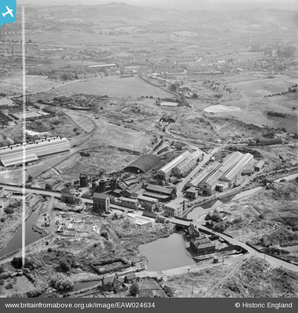
EAW024634 ENGLAND (1949). M & W Grazebrook Ltd Works on Peartree Lane, Netherton, from the west, 1949. This image was marked by Aerofilms Ltd for photo editing.
© Copyright OpenStreetMap contributors and licensed by the OpenStreetMap Foundation. 2026. Cartography is licensed as CC BY-SA.
Nearby Images (24)
EAW024634

EAW024635

EAW024638

EPW046057

EAW000683

EPW046055

EAW024639

EPW046056

EAW024640

EAW000686

EAW024633

EAW024637

EPW046058

EPW046061

EPW046060

EPW046059

EAW024636

EAW000682

EAW000684

EAW000685

EAW027698

EAW041760
 Ltd Windmill Engineering Works, Dudley, 1952. This image has been produced from a damaged negative.")
EAW041766
 Ltd Windmill Engineering Works, Dudley, 1952. This image has been produced from a damaged negative.")
EAW041767
 Ltd Windmill Engineering Works, Dudley, 1952. This image has been produced from a damaged negative.")
Details
| Title | [EAW024634] M & W Grazebrook Ltd Works on Peartree Lane, Netherton, from the west, 1949. This image was marked by Aerofilms Ltd for photo editing. |
| Reference | EAW024634 |
| Date | 12-July-1949 |
| Link | |
| Place name | NETHERTON |
| Parish | |
| District | |
| Country | ENGLAND |
| Easting / Northing | 393487, 288851 |
| Longitude / Latitude | -2.0959474514029, 52.497158788671 |
| National Grid Reference | SO935889 |
Pins

Steve |
Wednesday 3rd of October 2018 11:50:46 AM |