
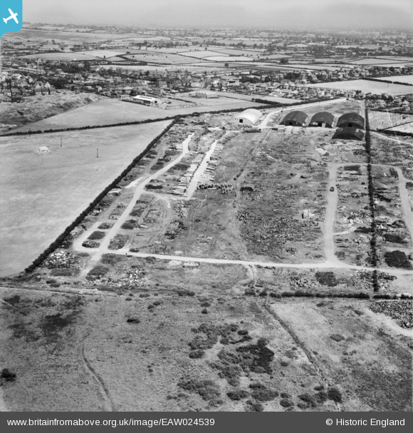
EAW024539 ENGLAND (1949). The site of the Cannock Chase Collieries, Chasetown, from the south-west, 1949
© Copyright OpenStreetMap contributors and licensed by the OpenStreetMap Foundation. 2026. Cartography is licensed as CC BY-SA.
Nearby Images (3)
EAW024539

EAW024540

EAW024532

Details
| Title | [EAW024539] The site of the Cannock Chase Collieries, Chasetown, from the south-west, 1949 |
| Reference | EAW024539 |
| Date | 8-July-1949 |
| Link | |
| Place name | CHASETOWN |
| Parish | BURNTWOOD |
| District | |
| Country | ENGLAND |
| Easting / Northing | 403933, 308857 |
| Longitude / Latitude | -1.9418225693445, 52.677054245779 |
| National Grid Reference | SK039089 |
Pins

areed |
Monday 4th of January 2021 04:29:06 PM | |
|
areed |
Thursday 23rd of April 2020 08:47:37 PM | |
|
areed |
Thursday 23rd of April 2020 08:46:33 PM | |
|
areed |
Thursday 23rd of April 2020 08:44:33 PM | |
|
areed |
Thursday 23rd of April 2020 08:44:18 PM |