
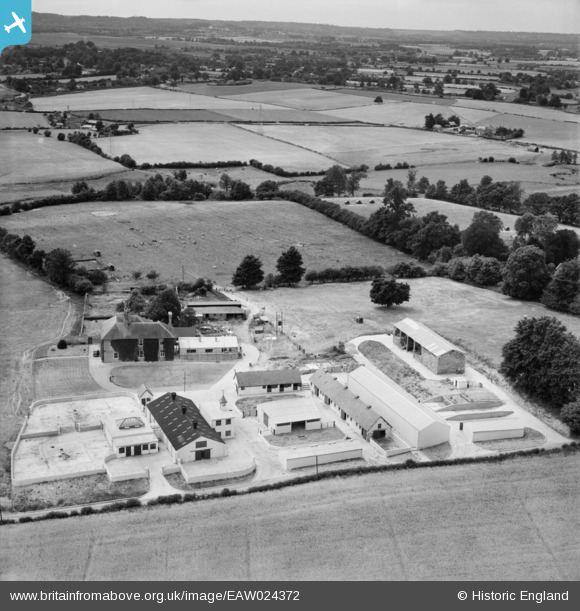
EAW024372 ENGLAND (1949). Manor Farm, East Wellow, 1949
© Copyright OpenStreetMap contributors and licensed by the OpenStreetMap Foundation. 2026. Cartography is licensed as CC BY-SA.
Nearby Images (11)
EAW024372

EAW024374

EAW043279

EAW043280

EAW043276

EAW043277

EAW043281

EAW043275

EAW043278

EAW024373

EAW024375

Details
| Title | [EAW024372] Manor Farm, East Wellow, 1949 |
| Reference | EAW024372 |
| Date | 6-July-1949 |
| Link | |
| Place name | EAST WELLOW |
| Parish | WELLOW |
| District | |
| Country | ENGLAND |
| Easting / Northing | 430306, 120257 |
| Longitude / Latitude | -1.5682433752032, 50.980378798323 |
| National Grid Reference | SU303203 |
Pins
Be the first to add a comment to this image!
User Comment Contributions
Great photo |

Christopher |
Saturday 21st of December 2013 08:22:21 PM |