
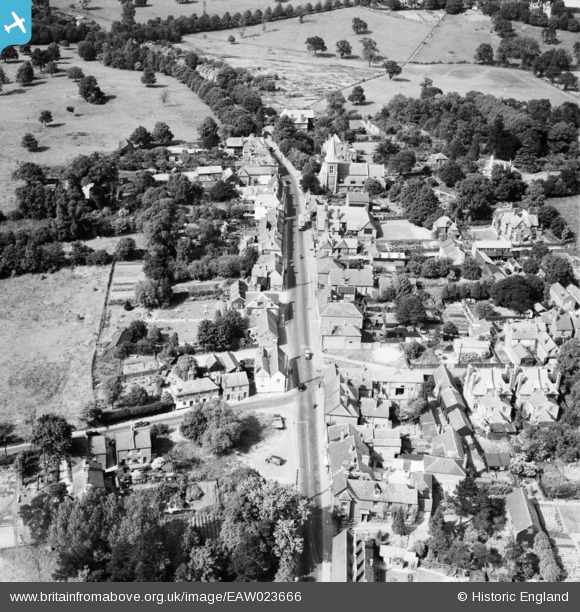
EAW023666 ENGLAND (1949). The village, Elstree, 1949
© Copyright OpenStreetMap contributors and licensed by the OpenStreetMap Foundation. 2026. Cartography is licensed as CC BY-SA.
Nearby Images (2)
EAW023666

EAW002188

Details
| Title | [EAW023666] The village, Elstree, 1949 |
| Reference | EAW023666 |
| Date | 12-June-1949 |
| Link | |
| Place name | ELSTREE |
| Parish | ELSTREE AND BOREHAMWOOD |
| District | |
| Country | ENGLAND |
| Easting / Northing | 517815, 195322 |
| Longitude / Latitude | -0.29710172545561, 51.643872809983 |
| National Grid Reference | TQ178953 |
Pins

John W |
Friday 3rd of March 2017 09:39:16 PM | |
|
John W |
Friday 3rd of March 2017 09:38:08 PM | |
|
John W |
Friday 3rd of March 2017 09:37:14 PM | |
|
erwoolley |
Sunday 16th of November 2014 10:40:19 PM | |
|
erwoolley |
Sunday 16th of November 2014 10:37:46 PM |