
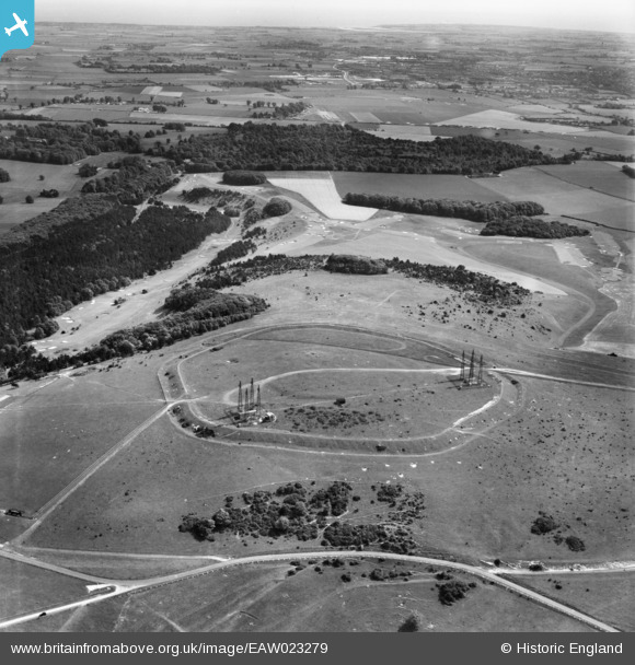
EAW023279 ENGLAND (1949). The Trundle, St Roche's Hill, from the north, 1949
© Copyright OpenStreetMap contributors and licensed by the OpenStreetMap Foundation. 2026. Cartography is licensed as CC BY-SA.
Nearby Images (3)
EAW023279

EAW023277

EAW023278

Details
| Title | [EAW023279] The Trundle, St Roche's Hill, from the north, 1949 |
| Reference | EAW023279 |
| Date | 19-May-1949 |
| Link | |
| Place name | ST ROCHE'S HILL |
| Parish | SINGLETON |
| District | |
| Country | ENGLAND |
| Easting / Northing | 487741, 111185 |
| Longitude / Latitude | -0.75231633768745, 50.892921425591 |
| National Grid Reference | SU877112 |
Pins

Sparky |
Monday 28th of August 2017 01:07:54 PM | |

Graham Yaxley |
Monday 16th of February 2015 01:59:55 PM |
