
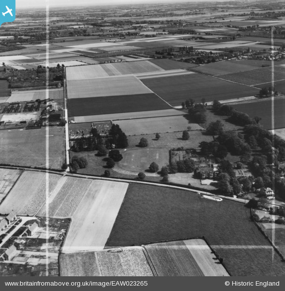
EAW023265 ENGLAND (1949). Lindfield School (The Chantry) on Foxbury Lane and the surrounding area, Westbourne, from the north-west, 1949. This image has been produced from a print marked by Aerofilms Ltd for photo editing.
© Copyright OpenStreetMap contributors and licensed by the OpenStreetMap Foundation. 2026. Cartography is licensed as CC BY-SA.
Nearby Images (4)
EAW023265
 on Foxbury Lane and the surrounding area, Westbourne, from the north-west, 1949. This image has been produced from a print marked by Aerofilms Ltd for photo editing.")
EAW023267
 on Foxbury Lane, Westbourne, 1949. This image was marked by Aerofilms Ltd for photo editing.")
EAW023266
 on Foxbury Lane, Westbourne, 1949. This image has been produced from a print.")
EAW023264
 on Foxbury Lane and the surrounding area, Westbourne, 1949. This image has been produced from a print marked by Aerofilms Ltd for photo editing.")
Details
| Title | [EAW023265] Lindfield School (The Chantry) on Foxbury Lane and the surrounding area, Westbourne, from the north-west, 1949. This image has been produced from a print marked by Aerofilms Ltd for photo editing. |
| Reference | EAW023265 |
| Date | 19-May-1949 |
| Link | |
| Place name | WESTBOURNE |
| Parish | WESTBOURNE |
| District | |
| Country | ENGLAND |
| Easting / Northing | 476000, 107564 |
| Longitude / Latitude | -0.91999300868626, 50.862026692479 |
| National Grid Reference | SU760076 |
Pins
Be the first to add a comment to this image!