
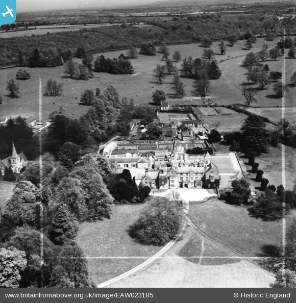
EAW023185 ENGLAND (1949). All Hallows Preparatory School, East Cranmore, from the west, 1949. This image has been produced from a print marked by Aerofilms Ltd for photo editing.
© Copyright OpenStreetMap contributors and licensed by the OpenStreetMap Foundation. 2025. Cartography is licensed as CC BY-SA.
Nearby Images (5)
EAW023185

EAW023259
, East Cranmore, 1949")
EAW023187

EAW023184

EAW023186

Details
| Title | [EAW023185] All Hallows Preparatory School, East Cranmore, from the west, 1949. This image has been produced from a print marked by Aerofilms Ltd for photo editing. |
| Reference | EAW023185 |
| Date | 6-May-1949 |
| Link | |
| Place name | EAST CRANMORE |
| Parish | CRANMORE |
| District | |
| Country | ENGLAND |
| Easting / Northing | 368127, 143751 |
| Longitude / Latitude | -2.4561536511692, 51.191572420041 |
| National Grid Reference | ST681438 |
Pins

orville |
Wednesday 2nd of October 2019 04:06:44 PM |