
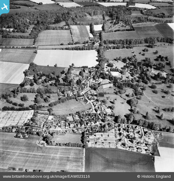
EAW023116 ENGLAND (1949). The village, Shoreham, 1949
© Copyright OpenStreetMap contributors and licensed by the OpenStreetMap Foundation. 2026. Cartography is licensed as CC BY-SA.
Nearby Images (6)
EAW023116

EAW023102

EAW023118

EAW023104

EAW023106

EAW023103

Details
| Title | [EAW023116] The village, Shoreham, 1949 |
| Reference | EAW023116 |
| Date | 10-May-1949 |
| Link | |
| Place name | SHOREHAM |
| Parish | SHOREHAM |
| District | |
| Country | ENGLAND |
| Easting / Northing | 552118, 161606 |
| Longitude / Latitude | 0.1838382194674, 51.332669488619 |
| National Grid Reference | TQ521616 |
Pins
Be the first to add a comment to this image!