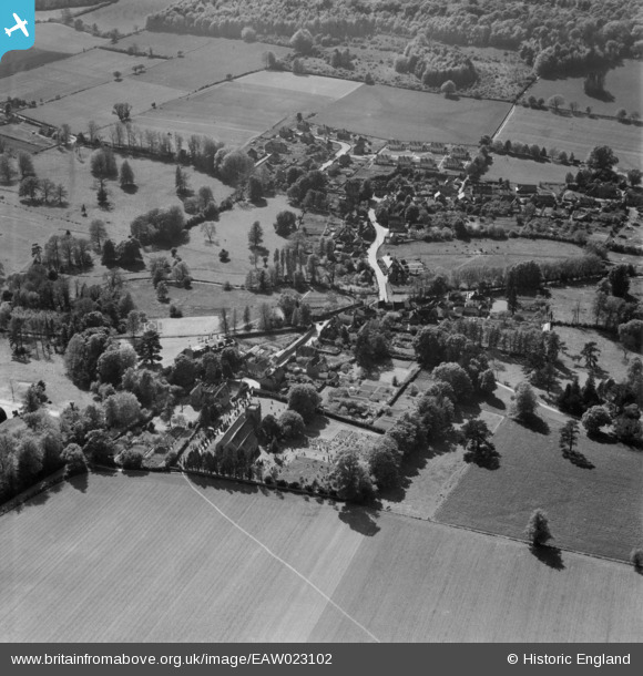
EAW023102 ENGLAND (1949). The village, Shoreham, 1949
© Copyright OpenStreetMap contributors and licensed by the OpenStreetMap Foundation. 2026. Cartography is licensed as CC BY-SA.
Nearby Images (6)
Details
| Title | [EAW023102] The village, Shoreham, 1949 |
| Reference | EAW023102 |
| Date | 10-May-1949 |
| Link | |
| Place name | SHOREHAM |
| Parish | SHOREHAM |
| District | |
| Country | ENGLAND |
| Easting / Northing | 552095, 161594 |
| Longitude / Latitude | 0.18350315949299, 51.332567807259 |
| National Grid Reference | TQ521616 |


![[EAW023102] The village, Shoreham, 1949](http://britainfromabove.org.uk/sites/all/libraries/aerofilms-images/public/100x100/EAW/023/EAW023102.jpg)
![[EAW023116] The village, Shoreham, 1949](http://britainfromabove.org.uk/sites/all/libraries/aerofilms-images/public/100x100/EAW/023/EAW023116.jpg)
![[EAW023118] The village and countryside to the north, Shoreham, from the south, 1949](http://britainfromabove.org.uk/sites/all/libraries/aerofilms-images/public/100x100/EAW/023/EAW023118.jpg)
![[EAW023106] The village, Shoreham, from the south-east, 1949](http://britainfromabove.org.uk/sites/all/libraries/aerofilms-images/public/100x100/EAW/023/EAW023106.jpg)
![[EAW023104] Church Street and the village, Shoreham, 1949](http://britainfromabove.org.uk/sites/all/libraries/aerofilms-images/public/100x100/EAW/023/EAW023104.jpg)
![[EAW023103] Manor Drain, Marne Cottages, Church Street and environs, Shoreham, 1949](http://britainfromabove.org.uk/sites/all/libraries/aerofilms-images/public/100x100/EAW/023/EAW023103.jpg)
