
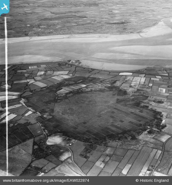
EAW022874 ENGLAND (1949). Peat cutting, Glasson Moss, from the south, 1949. This image has been produced from a print marked by Aerofilms Ltd for photo editing.
© Copyright OpenStreetMap contributors and licensed by the OpenStreetMap Foundation. 2026. Cartography is licensed as CC BY-SA.
Nearby Images (3)
EAW022874

EAW022873

EAW022868

Details
| Title | [EAW022874] Peat cutting, Glasson Moss, from the south, 1949. This image has been produced from a print marked by Aerofilms Ltd for photo editing. |
| Reference | EAW022874 |
| Date | 26-April-1949 |
| Link | |
| Place name | GLASSON MOSS |
| Parish | BOWNESS |
| District | |
| Country | ENGLAND |
| Easting / Northing | 323398, 559607 |
| Longitude / Latitude | -3.1954169683332, 54.925184104633 |
| National Grid Reference | NY234596 |
Pins

redmist |
Tuesday 9th of February 2021 07:50:13 PM |