
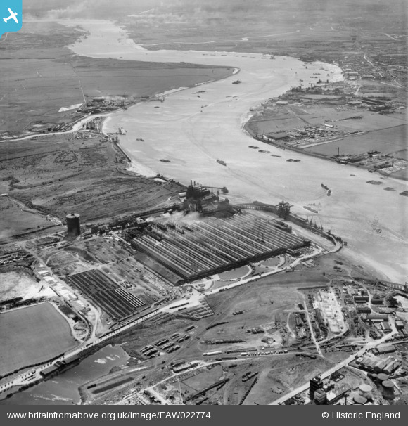
EAW022774 ENGLAND (1949). The Ford Motor Company Works and the River Thames, Dagenham, from the north-west, 1949
© Copyright OpenStreetMap contributors and licensed by the OpenStreetMap Foundation. 2026. Cartography is licensed as CC BY-SA.
Nearby Images (22)
EAW022774

EPW055195

EAW041033

EAW029519

EPW062036

EPW009956

EPW046915

EPW060999

EAW041029

EAW000070

EAW022764

EPW061001

EPW046938

EPW055196

EAW053048

EAW053046

EPW061003

EAW053045

EPW055198

EPW055200

EAW022776

EPW061002

Details
| Title | [EAW022774] The Ford Motor Company Works and the River Thames, Dagenham, from the north-west, 1949 |
| Reference | EAW022774 |
| Date | 29-April-1949 |
| Link | |
| Place name | DAGENHAM |
| Parish | |
| District | |
| Country | ENGLAND |
| Easting / Northing | 549320, 181944 |
| Longitude / Latitude | 0.15227226177074, 51.516174566218 |
| National Grid Reference | TQ493819 |
Pins
Be the first to add a comment to this image!