
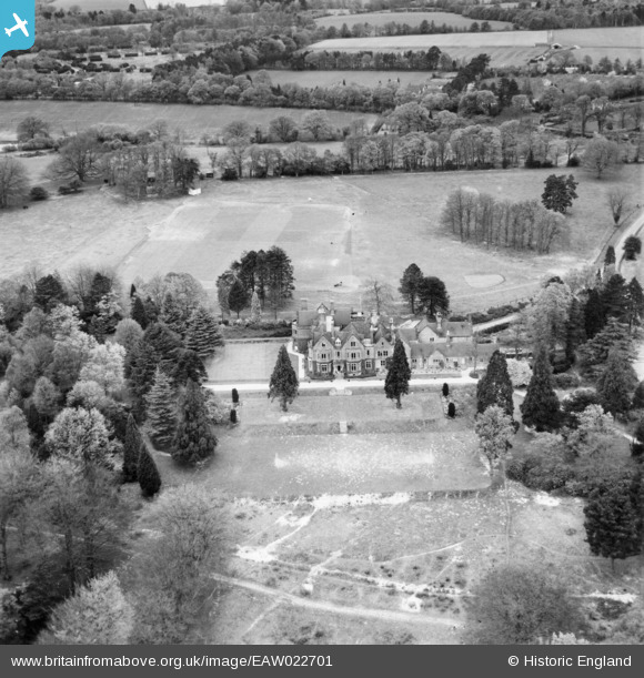
EAW022701 ENGLAND (1949). Newells School, Lower Beeding, 1949
© Copyright OpenStreetMap contributors and licensed by the OpenStreetMap Foundation. 2025. Cartography is licensed as CC BY-SA.
Nearby Images (5)
EAW022701

EAW022700

EAW022702

EAW022704

EAW022703

Details
| Title | [EAW022701] Newells School, Lower Beeding, 1949 |
| Reference | EAW022701 |
| Date | 25-April-1949 |
| Link | |
| Place name | LOWER BEEDING |
| Parish | LOWER BEEDING |
| District | |
| Country | ENGLAND |
| Easting / Northing | 521223, 126625 |
| Longitude / Latitude | -0.27125467152471, 51.025657865136 |
| National Grid Reference | TQ212266 |
Pins
Be the first to add a comment to this image!