
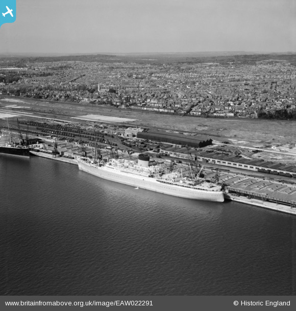
EAW022291 ENGLAND (1949). A Union-Castle Line ship at the New Docks (Western Docks), Southampton, 1949
© Copyright OpenStreetMap contributors and licensed by the OpenStreetMap Foundation. 2026. Cartography is licensed as CC BY-SA.
Nearby Images (6)
EAW022291
, Southampton, 1949")
EPW032347

EAW022292
, Southampton, 1949")
EAW020015

EAW001338
, Southampton, 1946")
EAW001344
, Southampton, from the south, 1946")
Details
| Title | [EAW022291] A Union-Castle Line ship at the New Docks (Western Docks), Southampton, 1949 |
| Reference | EAW022291 |
| Date | 18-April-1949 |
| Link | |
| Place name | SOUTHAMPTON |
| Parish | |
| District | |
| Country | ENGLAND |
| Easting / Northing | 440686, 111767 |
| Longitude / Latitude | -1.421319572983, 50.903388906034 |
| National Grid Reference | SU407118 |
Pins
Be the first to add a comment to this image!