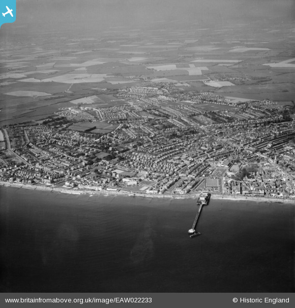
EAW022233 ENGLAND (1949). The Pier and the town, Bognor Regis, from the south-east, 1949
    © Copyright OpenStreetMap contributors and licensed by the OpenStreetMap Foundation. 2025. Cartography is licensed as CC BY-SA.
  
Nearby Images (16)
Details
| Title | [EAW022233] The Pier and the town, Bognor Regis, from the south-east, 1949 | 
| Reference | EAW022233 | 
| Date | 17-May-1949 | 
| Link | |
| Place name | BOGNOR REGIS | 
| Parish | BOGNOR REGIS | 
| District | |
| Country | ENGLAND | 
| Easting / Northing | 493294, 98659 | 
| Longitude / Latitude | -0.67656377854472, 50.779428123969 | 
| National Grid Reference | SZ933987 | 
Pins
|  Southdown Motor Services first garage in the town. Junction of Richmond Rd and Station Rd. Used 1919-1957 when exchanged with Hall & Co, builders' merchants for their garage in Bedford Street adjacent to the yard of Bognor Bus and Coach Station. |   Stephen Mirrington | Wednesday 25th of August 2021 11:23:22 AM | 
|  The Pavilion showing fire damage - now a car park. |   ordinarybloke | Monday 28th of December 2020 10:21:14 AM | 
| Shown here after the fire. The right tower missing, and what looks like make-shift repairs. |   ordinarybloke | Tuesday 7th of January 2014 04:18:00 PM | 
|   ordinarybloke | Monday 28th of December 2020 10:19:11 AM | |
|   ordinarybloke | Saturday 2nd of May 2020 08:50:07 AM | |
|   ordinarybloke | Monday 15th of April 2019 10:07:26 AM | |
|   ordinarybloke | Saturday 28th of June 2014 07:44:41 PM | |
|  A crowded beach for April? Must have been a very sunny day, but then perhaps people weren't the lily-livered pansies we all are today? |   ordinarybloke | Friday 13th of June 2014 08:17:27 AM | 
|  Esplanade Theatre |   coastal_dweller | Friday 7th of February 2014 06:56:04 PM | 
|  Pavilion Garden. Shown is the lily pond, and there was a rustic bridge that went over the path into this garden, not surviving in this pic. |   ordinarybloke | Monday 6th of January 2014 09:14:01 PM | 
|  Princess Elizabeth Yacht Pond Bognor |   ordinarybloke | Monday 6th of January 2014 09:09:43 PM | 
|  Chichester Road, original alignment, this part now known as "Babsham Lane". I would add that this is now the western boundary for urban Bognor Regis! |   JerryE | Monday 30th of December 2013 09:14:05 PM | 
|  Aldwick Road junction with Hawthorn Road, this is now a roundabout and the start of the "West Meads" housing development of the 1960s. |   JerryE | Monday 30th of December 2013 09:05:22 PM | 
|  Pevensey Road |   JerryE | Monday 30th of December 2013 08:55:13 PM | 
|  Bognor Regis School |   JerryE | Monday 30th of December 2013 08:53:36 PM | 
|  Cricket Ground with pavilion |   JerryE | Monday 30th of December 2013 08:52:14 PM | 
|  Hawthorn Road |   JerryE | Monday 30th of December 2013 08:50:48 PM | 
|  Demolished to make way for a 1960s road, car park and access to new tower block development. |   JerryE | Saturday 28th of December 2013 10:16:34 PM | 
| Merchant Taylors [There is a postcard of the rear of this building] see other aerial veiw |   ordinarybloke | Tuesday 7th of January 2014 01:57:06 AM | 
|  This site is now a supermarket and multi-story car park (built late 1970s). |   JerryE | Saturday 28th of December 2013 10:13:32 PM | 
|  Railway station |   JerryE | Saturday 28th of December 2013 10:05:27 PM | 
|  The Bognor Bus station, this Art Deco building was demolished in the 1990s to make way for a supermarket car park. |   JerryE | Saturday 28th of December 2013 10:04:35 PM | 
| A tragedy, that was a building with Listed status written all over it. |   ordinarybloke | Tuesday 7th of January 2014 04:19:17 PM | 
|  Railway Goods shed |   JerryE | Saturday 28th of December 2013 10:00:28 PM | 
|  Locomotive sheds |   JerryE | Saturday 28th of December 2013 09:59:15 PM | 
 
             
  ![[EAW022233] The Pier and the town, Bognor Regis, from the south-east, 1949](http://britainfromabove.org.uk/sites/all/libraries/aerofilms-images/public/100x100/EAW/022/EAW022233.jpg) 
  
                                          ![[EAW022236] The Pier and the town, Bognor Regis, from the south, 1949](http://britainfromabove.org.uk/sites/all/libraries/aerofilms-images/public/100x100/EAW/022/EAW022236.jpg) 
 ![[EAW046504] The pier and town, Bognor Regis, from the south, 1952](http://britainfromabove.org.uk/sites/all/libraries/aerofilms-images/public/100x100/EAW/046/EAW046504.jpg) 
 ![[EPW040107] Waterloo Square and the town, Bognor Regis, 1932](http://britainfromabove.org.uk/sites/all/libraries/aerofilms-images/public/100x100/EPW/040/EPW040107.jpg) 
 ![[EAW046803] The pier and the town, Bognor Regis, from the south, 1952](http://britainfromabove.org.uk/sites/all/libraries/aerofilms-images/public/100x100/EAW/046/EAW046803.jpg) 
 ![[EPW040096] The Royal Norfolk Hotel, Bognor Regis, 1932](http://britainfromabove.org.uk/sites/all/libraries/aerofilms-images/public/100x100/EPW/040/EPW040096.jpg) 
 ![[EPW040097] The Royal Norfolk Hotel, bandstand and environs, Bognor Regis, 1932](http://britainfromabove.org.uk/sites/all/libraries/aerofilms-images/public/100x100/EPW/040/EPW040097.jpg) 
 ![[EPW040095] The Royal Norfolk Hotel, Bognor Regis, 1932](http://britainfromabove.org.uk/sites/all/libraries/aerofilms-images/public/100x100/EPW/040/EPW040095.jpg) 
 ![[EPW016854] The Royal Norfolk Hotel, Bognor Regis, 1926](http://britainfromabove.org.uk/sites/all/libraries/aerofilms-images/public/100x100/EPW/016/EPW016854.jpg) 
 ![[EPW016907] The Royal Norfolk Hotel, Bognor Regis, 1926](http://britainfromabove.org.uk/sites/all/libraries/aerofilms-images/public/100x100/EPW/016/EPW016907.jpg) 
 ![[EPW000760] Waterloo Square and the Pier, Bognor Regis, 1920](http://britainfromabove.org.uk/sites/all/libraries/aerofilms-images/public/100x100/EPW/000/EPW000760.jpg) 
 ![[EAW046802] Rock Gardens, the Royal Norfolk Hotel and the town, Bognor Regis, from the south-east, 1952](http://britainfromabove.org.uk/sites/all/libraries/aerofilms-images/public/100x100/EAW/046/EAW046802.jpg) 
 ![[EPW040108] The pier and the town, Bognor Regis, from the south, 1932](http://britainfromabove.org.uk/sites/all/libraries/aerofilms-images/public/100x100/EPW/040/EPW040108.jpg) 
 ![[EAW046804] The pier and the town, Bognor Regis, from the east, 1952](http://britainfromabove.org.uk/sites/all/libraries/aerofilms-images/public/100x100/EAW/046/EAW046804.jpg) 
 ![[EPW040100] Marine Drive from the pier to York Road, Bognor Regis, 1932](http://britainfromabove.org.uk/sites/all/libraries/aerofilms-images/public/100x100/EPW/040/EPW040100.jpg) 
 ![[EPW040105] Marine Drive, Bognor Regis, 1932](http://britainfromabove.org.uk/sites/all/libraries/aerofilms-images/public/100x100/EPW/040/EPW040105.jpg) 


