
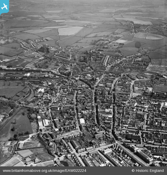
EAW022224 ENGLAND (1949). The town, Newport, 1949
© Copyright OpenStreetMap contributors and licensed by the OpenStreetMap Foundation. 2026. Cartography is licensed as CC BY-SA.
Nearby Images (10)
EAW022224

EPW039660

EPW032333

EAW015247

EPW023022

EPW032330

EPW032329

EAW015248

EPW023021

EAW022225

Details
| Title | [EAW022224] The town, Newport, 1949 |
| Reference | EAW022224 |
| Date | 17-April-1949 |
| Link | |
| Place name | NEWPORT |
| Parish | NEWPORT |
| District | |
| Country | ENGLAND |
| Easting / Northing | 450055, 89296 |
| Longitude / Latitude | -1.2911376535205, 50.700573178196 |
| National Grid Reference | SZ501893 |
Pins

wessexpig |
Tuesday 27th of May 2014 07:02:22 PM | |
|
wessexpig |
Tuesday 27th of May 2014 06:46:10 PM | |
|
wessexpig |
Tuesday 27th of May 2014 06:44:03 PM | |
|
wessexpig |
Tuesday 27th of May 2014 06:41:54 PM |