
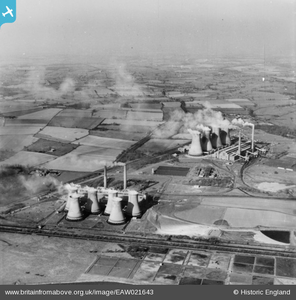
EAW021643 ENGLAND (1949). Hams Hall Power Station, Curdworth, from the south, 1949. This image has been produced from a print.
© Copyright OpenStreetMap contributors and licensed by the OpenStreetMap Foundation. 2026. Cartography is licensed as CC BY-SA.
Nearby Images (25)
EAW021643

EPW060882

EPW023694

EPW060883

EPW060872

EPW060878

EAW021639

EPW060884

EPW060876

EPW060880

EAW021642

EPW060885

EPW060886

EPW023690

EAW021645

EPW023682

EPW023686

EPW023691

EPW023688

EPW023687

EPW023683

EPW023684

EPW023692

EPW023680

EAW021641

Details
| Title | [EAW021643] Hams Hall Power Station, Curdworth, from the south, 1949. This image has been produced from a print. |
| Reference | EAW021643 |
| Date | 25-March-1949 |
| Link | |
| Place name | CURDWORTH |
| Parish | CURDWORTH |
| District | |
| Country | ENGLAND |
| Easting / Northing | 419556, 291860 |
| Longitude / Latitude | -1.7117320086592, 52.523900463681 |
| National Grid Reference | SP196919 |
Pins
Be the first to add a comment to this image!