
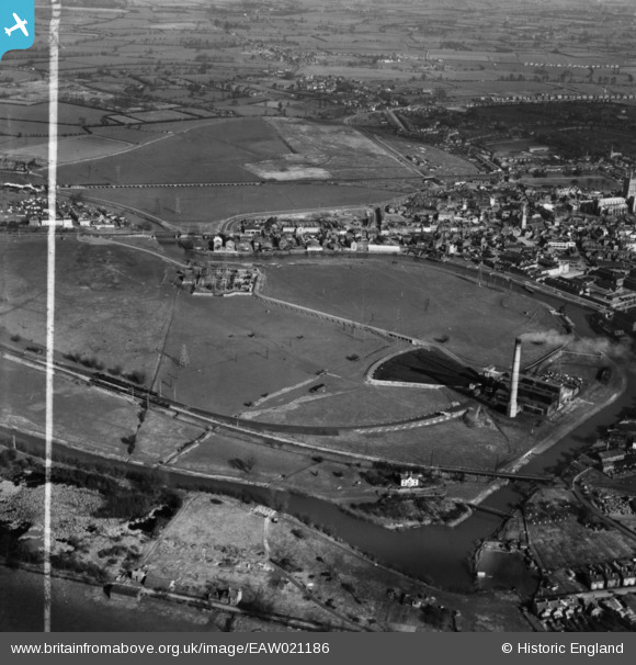
EAW021186 ENGLAND (1949). Castle Meads Power Station and environs, Gloucester, 1949. This image has been produced from a print marked by Aerofilms Ltd for photo editing
© Copyright OpenStreetMap contributors and licensed by the OpenStreetMap Foundation. 2026. Cartography is licensed as CC BY-SA.
Nearby Images (8)
EAW021186

EAW021189

EAW021183

EAW021188

EAW021187

EAW012209

EPW024161

EAW012207

Details
| Title | [EAW021186] Castle Meads Power Station and environs, Gloucester, 1949. This image has been produced from a print marked by Aerofilms Ltd for photo editing |
| Reference | EAW021186 |
| Date | 2-March-1949 |
| Link | |
| Place name | GLOUCESTER |
| Parish | |
| District | |
| Country | ENGLAND |
| Easting / Northing | 382449, 218610 |
| Longitude / Latitude | -2.2549177649875, 51.865352164913 |
| National Grid Reference | SO824186 |
Pins
 |

Class31 |
Wednesday 3rd of June 2015 08:32:05 PM |