
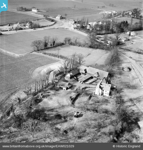
EAW021029 ENGLAND (1949). Chalks Farm and the village, Leaden Roding, 1949
© Copyright OpenStreetMap contributors and licensed by the OpenStreetMap Foundation. 2026. Cartography is licensed as CC BY-SA.
Nearby Images (2)
EAW021029

EAW021028

Details
| Title | [EAW021029] Chalks Farm and the village, Leaden Roding, 1949 |
| Reference | EAW021029 |
| Date | 16-February-1949 |
| Link | |
| Place name | LEADEN RODING |
| Parish | LEADEN RODING |
| District | |
| Country | ENGLAND |
| Easting / Northing | 559686, 213217 |
| Longitude / Latitude | 0.3158440574406, 51.79432607923 |
| National Grid Reference | TL597132 |
Pins
Be the first to add a comment to this image!