
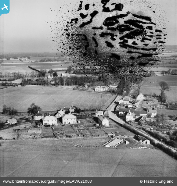
EAW021003 ENGLAND (1949). Turner's Green and the village, Britwell Salome, from the south-west, 1949. This image has been produced from a damaged negative.
© Copyright OpenStreetMap contributors and licensed by the OpenStreetMap Foundation. 2026. Cartography is licensed as CC BY-SA.
Nearby Images (2)
EAW021003

EAW021002

Details
| Title | [EAW021003] Turner's Green and the village, Britwell Salome, from the south-west, 1949. This image has been produced from a damaged negative. |
| Reference | EAW021003 |
| Date | 11-February-1949 |
| Link | |
| Place name | BRITWELL SALOME |
| Parish | BRITWELL SALOME |
| District | |
| Country | ENGLAND |
| Easting / Northing | 467060, 193251 |
| Longitude / Latitude | -1.0309557276652, 51.633598666262 |
| National Grid Reference | SU671933 |
Pins

Dennis Jackson |
Wednesday 3rd of December 2014 03:22:02 PM |