
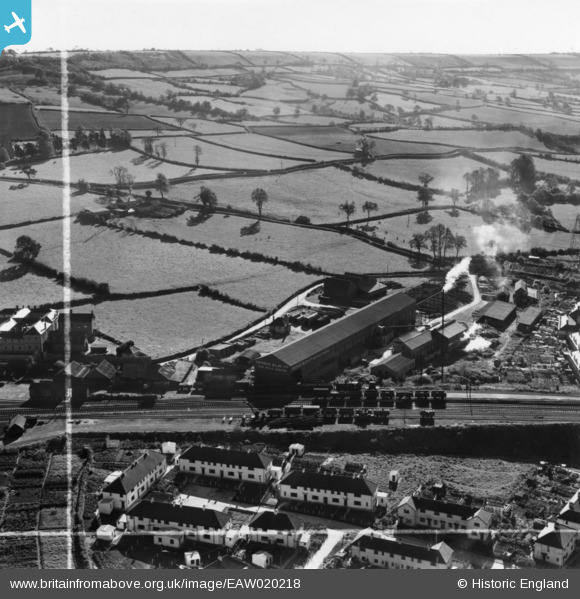
EAW020218 ENGLAND (1948). The George Blay Ltd Saw Mill, Honiton, from the north-west, 1948. This image has been produced from a print marked by Aerofilms Ltd for photo editing.
© Copyright OpenStreetMap contributors and licensed by the OpenStreetMap Foundation. 2026. Cartography is licensed as CC BY-SA.
Nearby Images (7)
EAW020218

EAW020222

EAW020220

EAW020223

EAW020219

EAW020224

EAW020221

Details
| Title | [EAW020218] The George Blay Ltd Saw Mill, Honiton, from the north-west, 1948. This image has been produced from a print marked by Aerofilms Ltd for photo editing. |
| Reference | EAW020218 |
| Date | 26-October-1948 |
| Link | |
| Place name | HONITON |
| Parish | HONITON |
| District | |
| Country | ENGLAND |
| Easting / Northing | 316276, 100237 |
| Longitude / Latitude | -3.1880720701106, 50.795078076586 |
| National Grid Reference | ST163002 |
Pins
Be the first to add a comment to this image!