
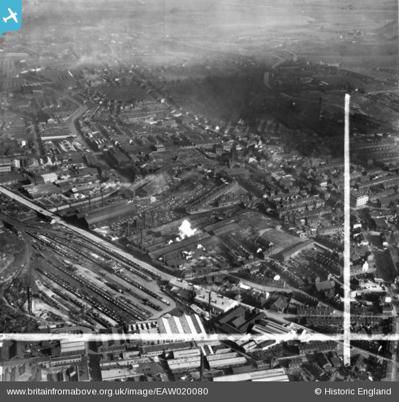
EAW020080 ENGLAND (1948). The English Steel Corporation Stevenson Road Works and environs, Attercliffe, 1948. This image has been produced from a print marked by Aerofilms Ltd for photo editing.
© Copyright OpenStreetMap contributors and licensed by the OpenStreetMap Foundation. 2026. Cartography is licensed as CC BY-SA.
Nearby Images (16)
EAW020080

EAW020085

EAW020081

EAW020083

EAW018791

EAW018789

EAW020084

EAW020087

EAW018792

EAW018788

EAW018787

EAW020082

EAW018790

EAW020086

EAW020078

EAW020079

Details
| Title | [EAW020080] The English Steel Corporation Stevenson Road Works and environs, Attercliffe, 1948. This image has been produced from a print marked by Aerofilms Ltd for photo editing. |
| Reference | EAW020080 |
| Date | 19-October-1948 |
| Link | |
| Place name | ATTERCLIFFE |
| Parish | |
| District | |
| Country | ENGLAND |
| Easting / Northing | 437740, 388880 |
| Longitude / Latitude | -1.4323902806231, 53.395139188048 |
| National Grid Reference | SK377889 |
Pins

Matt Aldred edob.mattaldred.com |
Monday 30th of November 2020 08:22:02 PM | |

Chris Kolonko |
Tuesday 12th of September 2017 09:04:37 PM |