
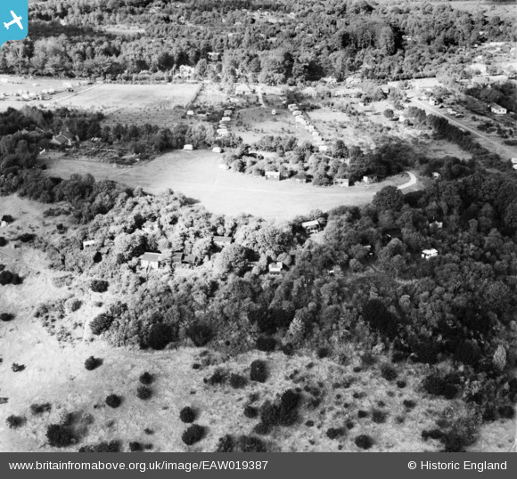
EAW019387 ENGLAND (1948). Betchworth Fort and environs, Box Hill, 1948
© Copyright OpenStreetMap contributors and licensed by the OpenStreetMap Foundation. 2026. Cartography is licensed as CC BY-SA.
Nearby Images (5)
EAW019387

EAW019376

EAW019386

EAW019380

EAW019379

Details
| Title | [EAW019387] Betchworth Fort and environs, Box Hill, 1948 |
| Reference | EAW019387 |
| Date | 30-September-1948 |
| Link | |
| Place name | BOX HILL |
| Parish | |
| District | |
| Country | ENGLAND |
| Easting / Northing | 520081, 151390 |
| Longitude / Latitude | -0.27927544521531, 51.248510813993 |
| National Grid Reference | TQ201514 |
Pins
Be the first to add a comment to this image!