
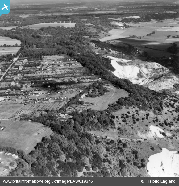
EAW019376 ENGLAND (1948). Betchworth Fort and Betchworth Hills Wood alongside the Betchworth Lime Works quarry, Box Hill, 1948. This image has been produced from a print.
© Copyright OpenStreetMap contributors and licensed by the OpenStreetMap Foundation. 2026. Cartography is licensed as CC BY-SA.
Nearby Images (7)
EAW019376

EAW019386

EAW019387

EAW019379

EAW019375

EAW019380

EAW019368

Details
| Title | [EAW019376] Betchworth Fort and Betchworth Hills Wood alongside the Betchworth Lime Works quarry, Box Hill, 1948. This image has been produced from a print. |
| Reference | EAW019376 |
| Date | 30-September-1948 |
| Link | |
| Place name | BOX HILL |
| Parish | |
| District | |
| Country | ENGLAND |
| Easting / Northing | 520078, 151514 |
| Longitude / Latitude | -0.27927680400578, 51.249626061143 |
| National Grid Reference | TQ201515 |
Pins

Dan Gregory |
Sunday 14th of September 2014 12:00:31 AM | |
|
Dan Gregory |
Sunday 14th of September 2014 12:00:05 AM |