
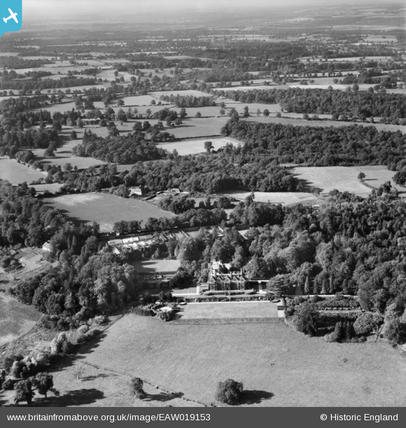
EAW019153 ENGLAND (1948). Hollington House and surrounding countryside, Woolton Hill, from the south-east, 1948
© Copyright OpenStreetMap contributors and licensed by the OpenStreetMap Foundation. 2025. Cartography is licensed as CC BY-SA.
Nearby Images (5)
EAW019153

EAW019150

EAW019151

EAW019149

EAW019152

Details
| Title | [EAW019153] Hollington House and surrounding countryside, Woolton Hill, from the south-east, 1948 |
| Reference | EAW019153 |
| Date | 30-September-1948 |
| Link | |
| Place name | WOOLTON HILL |
| Parish | EAST WOODHAY |
| District | |
| Country | ENGLAND |
| Easting / Northing | 442515, 160981 |
| Longitude / Latitude | -1.3895007822252, 51.345817846803 |
| National Grid Reference | SU425610 |
Pins
Be the first to add a comment to this image!