
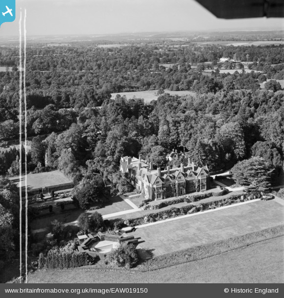
EAW019150 ENGLAND (1948). Hollington House, Woolton Hill, from the south, 1948. This image was marked by Aerofilms Ltd for photo editing.
© Copyright OpenStreetMap contributors and licensed by the OpenStreetMap Foundation. 2025. Cartography is licensed as CC BY-SA.
Nearby Images (5)
EAW019150

EAW019153

EAW019151

EAW019149

EAW019152

Details
| Title | [EAW019150] Hollington House, Woolton Hill, from the south, 1948. This image was marked by Aerofilms Ltd for photo editing. |
| Reference | EAW019150 |
| Date | 30-September-1948 |
| Link | |
| Place name | WOOLTON HILL |
| Parish | EAST WOODHAY |
| District | |
| Country | ENGLAND |
| Easting / Northing | 442496, 160995 |
| Longitude / Latitude | -1.3897719263456, 51.345945159468 |
| National Grid Reference | SU425610 |
Pins
Be the first to add a comment to this image!