
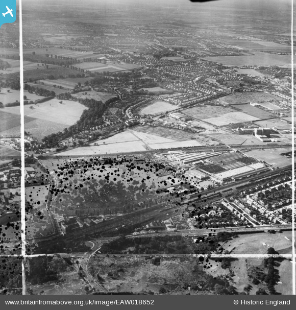
EAW018652 ENGLAND (1948). The Associated Equipment Company (AEC) Motor Works and the surrounding area, Southall, from the north-east, 1948. This image has been produced from a damaged negative.
© Copyright OpenStreetMap contributors and licensed by the OpenStreetMap Foundation. 2026. Cartography is licensed as CC BY-SA.
Nearby Images (19)
EAW018652
 Motor Works and the surrounding area, Southall, from the north-east, 1948. This image has been produced from a damaged negative.")
EPW019292

EAW018655
 Motor Works, Southall, 1948. This image was marked by Aerofilms Ltd for photo editing.")
EPW035001
 crossing the Iron Bridge over the Uxbridge Road, Southall, 1931")
EPW035001
EPW019282

EPW019281

EPW019288

EPW031708

EAW018657
 Motor Works, Southall, 1948")
EPW017383
 motor works, Southall, 1927")
EPW019286

EAW018659
 Motor Works, Southall, 1948. This image was marked by Aerofilms Ltd for photo editing.")
EAW018653
 Motor Works and the surrounding area, Southall, 1948. This image was marked by Aerofilms Ltd for photo editing.")
EPW031705

EPW031709

EAW018651
 Motor Works (site of), Southall, 1948. This image has been produced from a damaged negative.")
EPW031710

EPW031707

Details
| Title | [EAW018652] The Associated Equipment Company (AEC) Motor Works and the surrounding area, Southall, from the north-east, 1948. This image has been produced from a damaged negative. |
| Reference | EAW018652 |
| Date | 9-September-1948 |
| Link | |
| Place name | SOUTHALL |
| Parish | |
| District | |
| Country | ENGLAND |
| Easting / Northing | 514040, 180112 |
| Longitude / Latitude | -0.35658032595648, 51.507933426207 |
| National Grid Reference | TQ140801 |
Pins

Billy Turner |
Tuesday 8th of September 2015 06:17:02 PM | |

southallboy |
Monday 18th of August 2014 04:07:23 PM | |
|
southallboy |
Monday 18th of August 2014 04:02:56 PM | |
|
southallboy |
Monday 18th of August 2014 04:01:10 PM | |
|
southallboy |
Monday 18th of August 2014 04:00:12 PM | |
|
southallboy |
Monday 18th of August 2014 03:58:56 PM | |
|
southallboy |
Monday 18th of August 2014 03:57:16 PM |
