
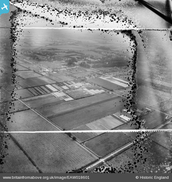
EAW018601 ENGLAND (1948). The A. G. West and Co Nurseries and the surrounding area, Cottingham, from the north-east, 1948. This image has been produced from a damaged negative.
© Copyright OpenStreetMap contributors and licensed by the OpenStreetMap Foundation. 2026. Cartography is licensed as CC BY-SA.
Nearby Images (6)
EAW018601

EAW018603

EAW018600

EAW018598

EAW018594

EAW018605

Details
| Title | [EAW018601] The A. G. West and Co Nurseries and the surrounding area, Cottingham, from the north-east, 1948. This image has been produced from a damaged negative. |
| Reference | EAW018601 |
| Date | 10-September-1948 |
| Link | |
| Place name | COTTINGHAM |
| Parish | COTTINGHAM |
| District | |
| Country | ENGLAND |
| Easting / Northing | 505956, 433385 |
| Longitude / Latitude | -0.39160060626423, 53.78577077169 |
| National Grid Reference | TA060334 |
Pins
Be the first to add a comment to this image!