
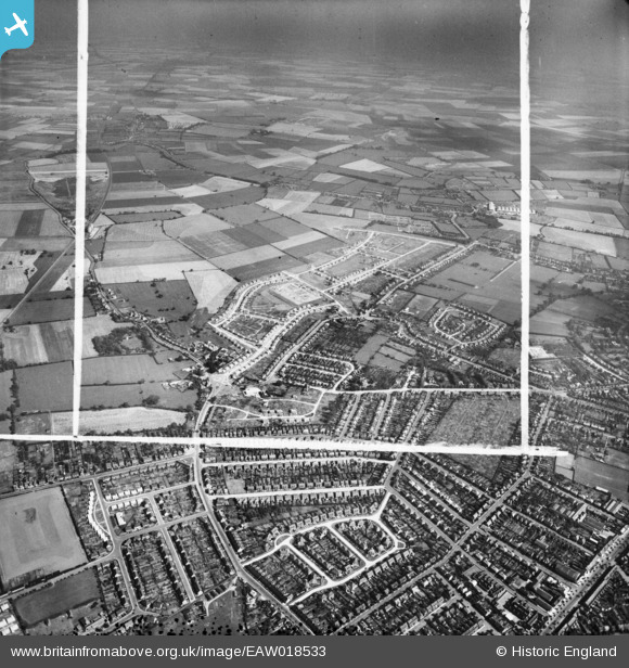
EAW018533 ENGLAND (1948). New housing development under construction at Dogsthorpe and environs, Peterborough, from the west, 1948. This image was marked by Aerofilms Ltd for photo editing.
© Copyright OpenStreetMap contributors and licensed by the OpenStreetMap Foundation. 2026. Cartography is licensed as CC BY-SA.
Nearby Images (3)
EAW018533

EPW044913

EPW044914

Details
| Title | [EAW018533] New housing development under construction at Dogsthorpe and environs, Peterborough, from the west, 1948. This image was marked by Aerofilms Ltd for photo editing. |
| Reference | EAW018533 |
| Date | 9-September-1948 |
| Link | |
| Place name | PETERBOROUGH |
| Parish | |
| District | |
| Country | ENGLAND |
| Easting / Northing | 518998, 301005 |
| Longitude / Latitude | -0.24304736235981, 52.593440939072 |
| National Grid Reference | TF190010 |
Pins

MSC |
Friday 19th of November 2021 09:29:24 PM | |

Class31 |
Tuesday 23rd of December 2014 08:06:31 AM | |
|
Class31 |
Wednesday 11th of June 2014 08:11:00 PM | |
|
Class31 |
Wednesday 11th of June 2014 08:05:50 PM | |
|
Class31 |
Wednesday 11th of June 2014 08:05:15 PM | |
|
Class31 |
Wednesday 11th of June 2014 09:11:04 AM |

